These pages contain reports of our weekly walks. Each page has 3 months of reports.
-
We headed north from the car park in Crickhowell and followed the road before joining the Cambrian Way up to Table Mountain. From there, we carried on to Pen Cerrig-Calch, stopping a little further along for coffee in a stone shelter out of the wind. We then continued to Pen Alt Mawr, the highest point of the day. Leaving the Cambrian Way, we turned south towards Pen Gloch-y-pibwr and descended to the South Wales Traverse, enjoying the views, before following the Beacons Way back to the car park. Other than a few spots, a dry day, with a cool wind on top.
-
Walking from Fro car park, we headed around the lower part of Bryn Arw, then following the less-trodden path through the dense bracken, which soon became less 'path' and more 'nature’s obstacle course'. Battling the foliage and scrambling down an increasingly steep slope, we eventually emerged at the bottom, beside the road near Coed-y-Cerrig Nature Reserve. With a much easier path we headed north west to Partrishow, but no church visit this week. Up Crug Mawr, to tap the trig, then following the Beacons Way encountering a cool wind, we walked down and round to Craig-y-bwla, after a short road section we skirted the lower part of the Sugar Loaf and back to the cars.
-
This was a repeat of the walk they did on 27th May to the source of the Monnow. Starting from Black Hill car park, we headed down into the Olchon Valley before climbing up to the pile of stones and joining the Offa’s Dyke Path. We followed this to Hay Bluff, then descended the north side, skirting around and gradually down the hill until we reached the source of the Monnow. We stopped there for lunch and enjoyed the views of small waterfalls, pools, and autumn hawthorn with red berries. After lunch, we continued along the foothills before a steep climb back up to Black Hill ridge, and finally, battling the wind, we descended via the Cat’s Back and returned to the cars. It was a dry day with good views, though windy at times.
-
While the phone and map were forgotten, we were touring the places of worship in the southern Black Mountains, so we had what felt like divine guidance, along with good weather and excellent visibility. We enjoyed splendid autumnal views from Crug Mawr and had coffee at St Issu while discussing Tudor politics. We then dropped down to Stanton and climbed up again for lunch, overlooking the lower Vale of Ewyas. After a brief stop at St Martin’s at Cwmyoy, we climbed back towards the Gaer and on to the Revenge Stone before heading down along a picturesque path and finally through the trees, with dappled light, back to the Pont Cadgwan car park. This is what divine inspiration looks like!
-
Leaving the Dinas Castle Inn car park in Pengenffordd, we started low, skirting around Pen Rhos Dirion with the air slightly damp from drizzle. Gradually, we made our way uphill to Rhiw Wen.
With the wind picking up, we headed back along the Cambrian Way before turning off for the lovely descent down the Dragon’s Back. We turned left just before the bottom and worked our way through the bracken, then made the final ascent over the remains of Dinas Castle before descending back to the cars.
-
Walked from the delightful St Dubricius Church (where Sue let us use the loos, and had the kettle on!) in Symonds Yat West up to Great Doward, via 2 diversions because:
• A gap in the lane was being filled and the workmen weren’t to be persuaded;
• A very cross man telling us we were walking on private property,
After King Arthur’s Cave, we climbed Little Doward where, after coffee, we saw drifts of naked ladies (Autumn Crocus). Then down through the meadow and woods to Biblins Bridge. Another steep climb up to Near Heartening Rock and the Suck Stone, enormous rocks perched precariously…
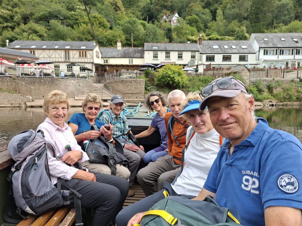
Through Lady Park Wood and down to the Slaughter and Symonds Yat East, where the hand-pulled ferry took us back across the river with a leisurely stroll back to the cars.
-
We met up in Senghenydd and donned our waterproofs for what we thought would be a showery day. However, this was an occasion where the actual weather turned out worse than forecast and we walked in persistent rain. Looking for a cafe for a sheltered morning coffee, we came across a Tesco, where Stewart bought some delicious cookies for our break.
We continued on our wet way past heaps of waste and towards a wind farm under construction (both scars on the landscape). Before reaching the construction site, we identified an opportunity to curtail the walk and head back to the cars. We briefly questioned our decision a few minutes later when a tiny sliver of blue sky teased us, but the clouds quickly closed back up and normal rainy service resumed.
Back in Senghenydd, we rounded off the day at the Welsh National and Universal Mining Disaster Memorial. It was a deeply moving and poignant tribute to the lives lost in the Welsh mines, bringing a thoughtful end to a soggy but memorable day out.
-
Rather chastened by leading a similar walk (11 Feb 2026: “The low-level path up the valley was very wet, muddy and uneven”) the walk leader opted for a route when, after 2 months of drought, he thought we might expect better conditions …..
Starting from Cwmdu VH, we walked across the usual fields thankfully, and unusually, bone dry. The walk up the road and track onto the foot of Pen Tir seemed rather steeper than previously and the climb had us peeling off initial extra layers – in fact with still air it was quite warm and humid. As the path levelled out, we enjoyed a pleasant breeze and excellent walking conditions with delightful colours of the light red/brown and green of the bilberries and the light mauve of the heather. Turning right at the cairn, we headed down towards Blaenau-draw, where the optimism of a better walk rather evaporated as we encountered denser bracken than anticipated, interspersed with nettles and very sharp hawthorn. Helen’s handy travel secateurs helped with the sharp stuff, but there was no protection from the bracken, still very wet from overnight rain. Again chastened we discussed whether to skip the path and walk up the road. Legolas Martin had scanned the route and deemed the path was a fair option. It was the correct decision, but a bit brackeny in parts – and importantly not a wet, muddy and uneven route!
The walk up Cockit Hill and south along the top was very pleasant, with good views in the sunshine. Down to Tre-graig and back across the fields – enjoying a few blackberries, a bit more bracken and the countryside smells of freshly spread manure, en-route.
-
Starting from Pontsticill Reservoir, we made our way up Gwaun y Pynt and towards the Taf Fawr watershed, traversing the strikingly barren landscape to reach the Cafn Car Settlement. There, we were treated to a fascinating tour of prehistoric and medieval earthworks, including remarkable limestone hut circles and animal enclosures, we also saw evidence of medieval long hut platform houses. Most of these structures date back to the late Bronze Age, around 1500–700 BC, and were likely used through to 500 BC–400 AD.
Afterwards, we returned over Garn Ddu and made our way back to the cars. After an interesting walk, we enjoyed what may be our final visit to the Old Barn Tea Rooms before they close in October, appreciating the delicious scones!
-
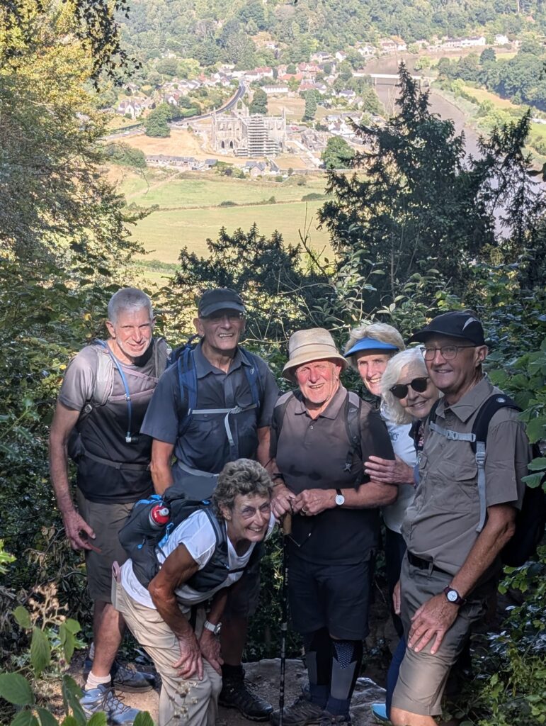
With wildfires burning on the Welsh hills and smoke drifting over a wide area, we decided to forego the pleasures of Mynydd Llangorse and instead headed for a mostly shaded walk on Offa’s Dyke Path and the woods to the west of Tintern. From the Wireworks CP we headed over the river Wye and up the gentle incline through Caswell Wood to Beeches Camp Site, then right along ODP, stopping for photos (and an investigation of a SWEB marked stone and dying sunflower) at the devil’s pulpit. Onwards towards Dennel Hill before cutting down the waymarked path to the lower paths. Unfortunately on the last section of the main descent, Helen slipped and tumbled on the loose surface, sustaining a few knocks and grazes which will take a while to heal – forehead, eye and nose looking very much worse for the experience. Speedy recovery wishes from all. We joined the Greenway at the north end of the tunnel from where Helen was driven home; the remainder continued along the low level path to Brockweir.
Over the river (very nice to see that Brockweir bridge has been resurfaced) and up the Wye Valley Walk to Botany Bay. Then return via Gurllus Grove, and Hale Woods back to the cars.
-
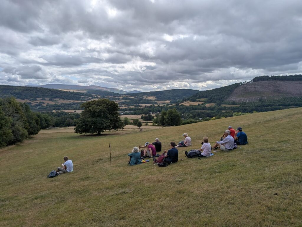
Usk Valley, The Bryn, Carn Pica and Allt Lwdd - The weather changed with some overnight rain which gave the day a slightly cooler feel than of late. We started our meandering walk-through woodland and fields along and around the Usk Valley walk. Just out of the car park we passed the second world war tank traps which had aimed to stop German tanks coming up from Merthyr. It is difficult to appreciate all that panic, on such a lovely morning, all those years ago.
As we came towards the 12th century church of St Meugan built on a pre-Christian site of worship. Strangely located half a mile outside the village of Pencelli. Hidden amongst some ancient Yews. Its tower contains 8 bells and is very popular with visiting bell ringers. Ancient but remodelled and restored by the Victorians at the end of the 19th century. Enthusiastic as they were had rid it of many wooden historic features. Some of these were found hidden in the Churchyard. They were recovered and reassembled to be placed back in the church.
We met Ceridwen as we approached the church who was on a Tea room walk recruitment mission. After we all volunteered to join, she left and went on to the next stage of her arrangement mission.
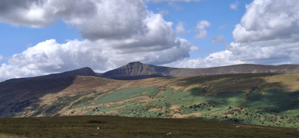
Climbing up towards and on the Bryn the temperature dropped as we were exposed to the wind . We were treated to a splendid panorama with tremendous views towards Fan Y Big and Pen Y Fan. On to the Crossroads where we turned on the path towards Carn Pica the wind had dropped and it warmed a little. From Carn Pica we skirted under the ridge toward Allt Lewd. Our high position and the clarity of the day, we were treated to a magnificent vista across the Beacons and the distant Black Mountains, concluding our wonderful days walk as we returned to the car park.
-
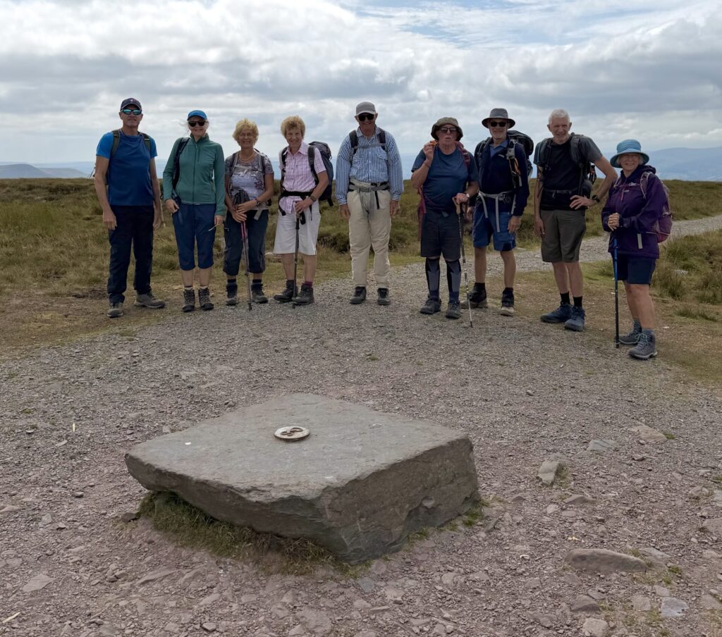
Llanbedr Horseshoe - anti-clockwise, taking in Crug Mawr, Pen y Gadair Fawr, Waun Fach, Pen Trumau, Pen Twyn Glas, Pen Allt Mawr, Pen Gloch-y-pibwr, Pen Cerrig Calch, and Table Mountain. The weather started off a bit worryingly warm, but it soon cooled as we climbed higher and moved further north. By the time we reached Waun Fach—the highest point—there was a cool breeze with temperatures around 19 degrees, making it absolutely perfect for the walk. Everything was dry underfoot and the views were fantastic.
-
Our last Cambrian Way day walk started at Tafarn y Garreg, following the Cambrian Way up Fan Hir under a bit of low cloud, which kept things nice and cool. From there we carried on over Fan Brycheiniog and Fan Foel, with fantastic views all around and plenty of reminders of the landscape's glacial past. We dropped down past Llyn y Fan Fach to the road, where we said goodbye to the Cambrian Way for now. The return was along the Beacons Way, including the long slog up the gravel road as the temperature started to climb, before making our way back to the cars beneath the high tops. A cracking day out and a great way to round off this stretch of the Cambrian Way.